Mount Tammany is the New Jersey side of the Delaware Water Gap. Mount Minsi is its pair across the river in Pennsylvania, and the view from Tammany of Minsi with the Delaware bending around it might be the best in the state. It’s also one of the most popular hikes in New Jersey, so expect company.
The standard Mount Tammany hike is a steep 3.7-mile loop with about 1,200 feet of climbing: up the Red Dot Trail and down the blue Pahaquarry Trail. Plan on about 2.5 hours.
I’ve photographed it in fog, fall color, snow and plain summer green. A few times it’s been my first hike of the year, on January 1. Two of my photos from up here ended up in print: one on the cover of the New Jersey Environmental Law Handbook, the other on the back insert of the NY-NJ Trail Conference’s Delaware Water Gap & Kittatinny Trails map set.
Jump to: photography guide · trail map and guide · parking · FAQ ↓
Last hiked: October 22, 2026 · Updated: November 18, 2026


The photographs come first: the view from the summit through the seasons, a few from the climb, and two of Tammany itself from farther up the Kittatinny Ridge. The trail guide, map and route directions follow.
Views from Mount Tammany
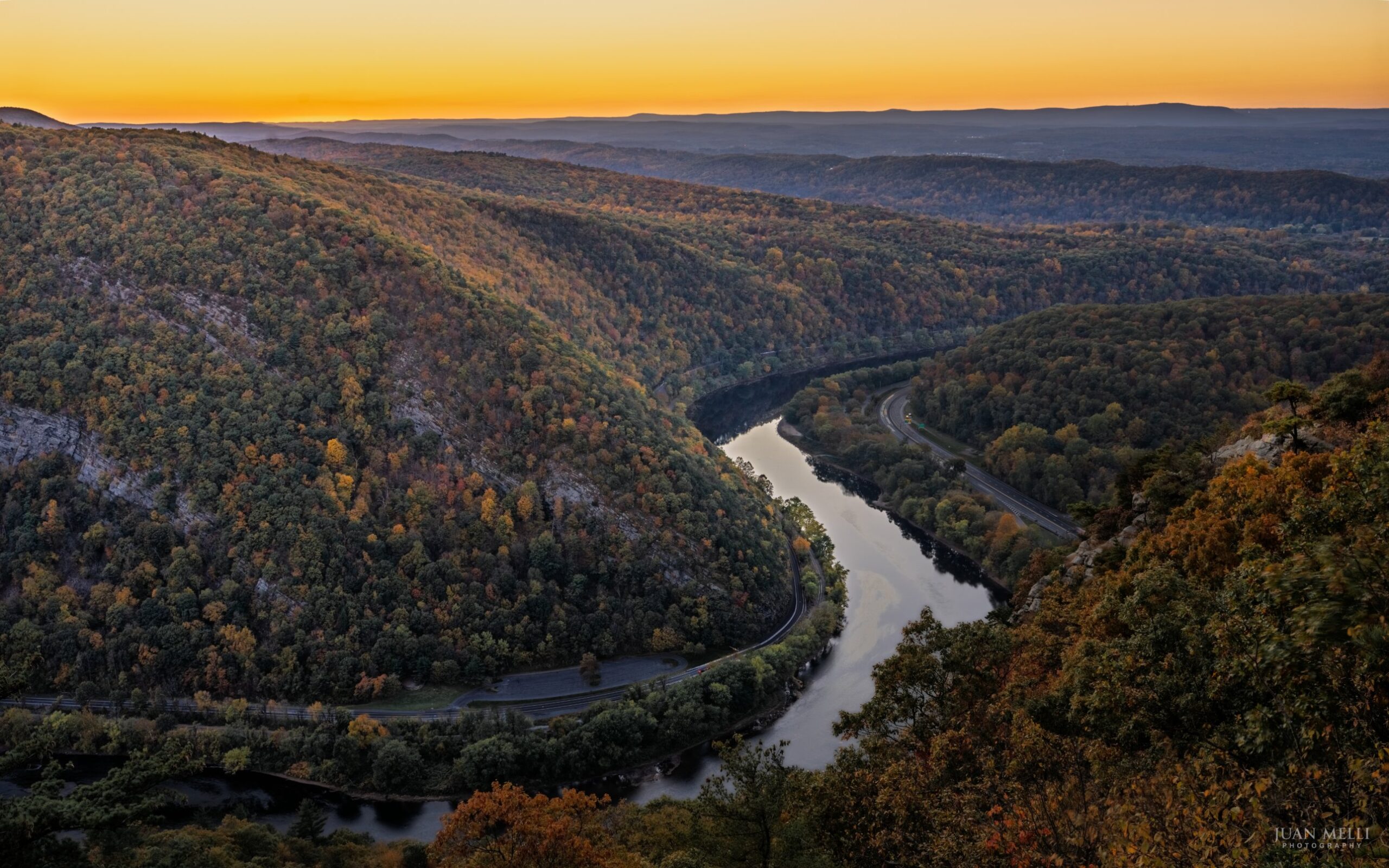

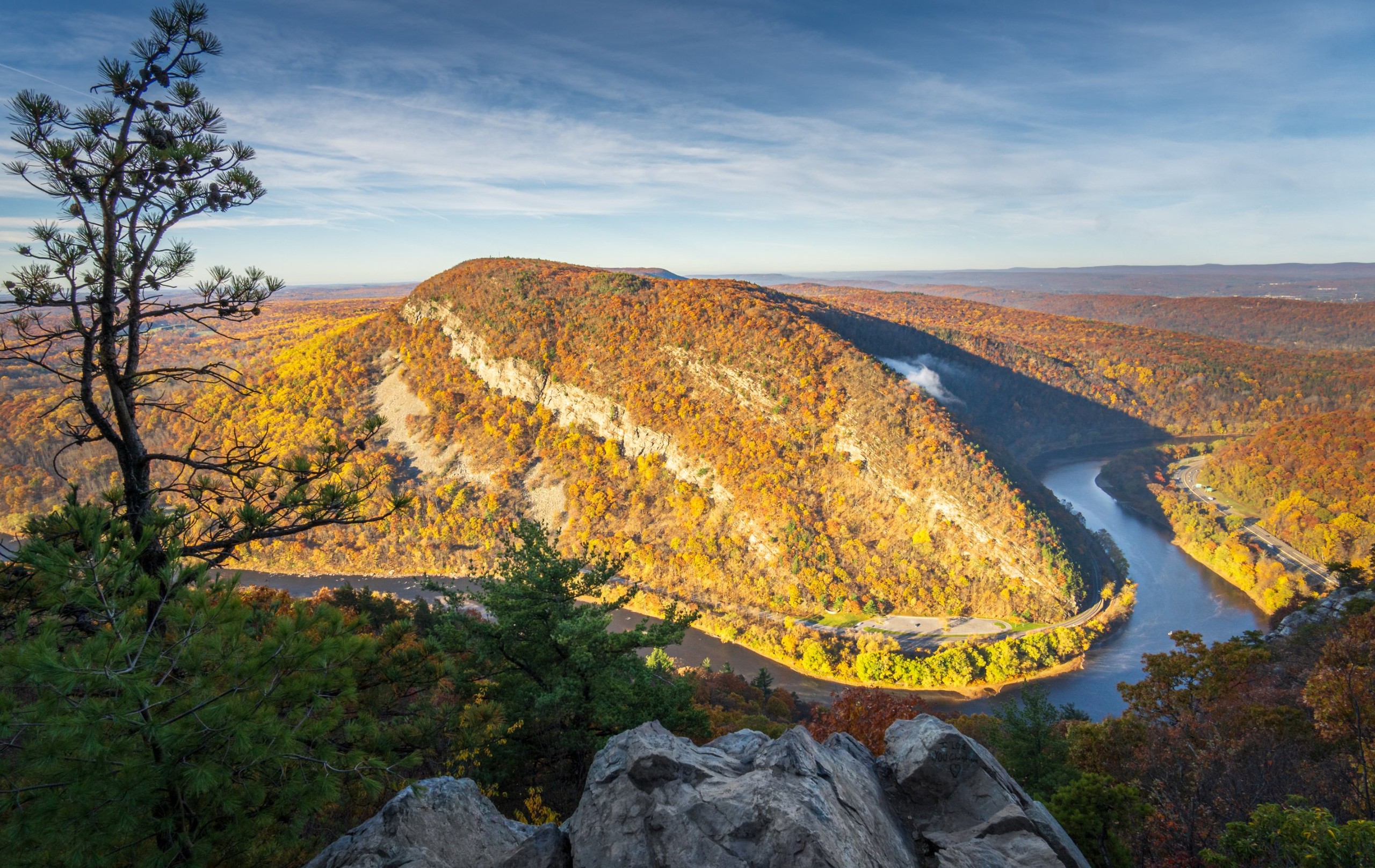

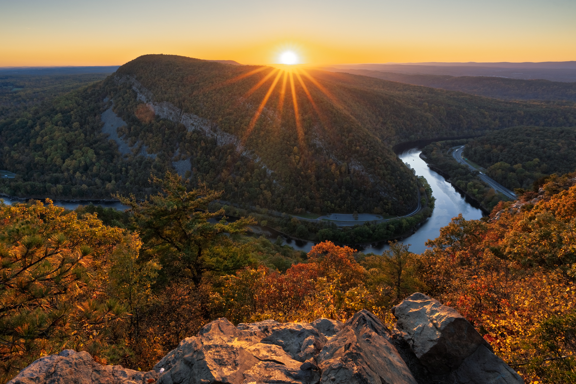

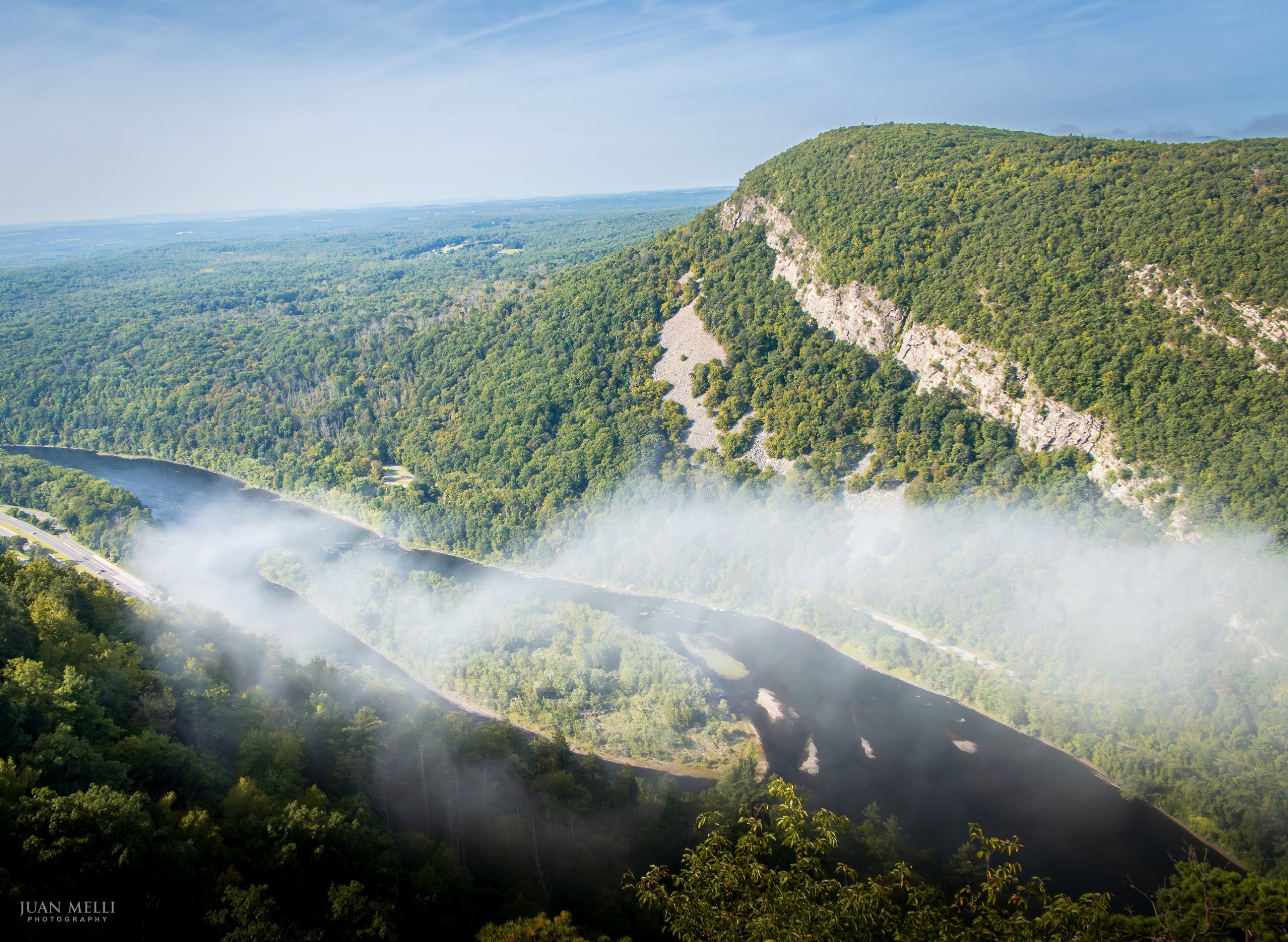


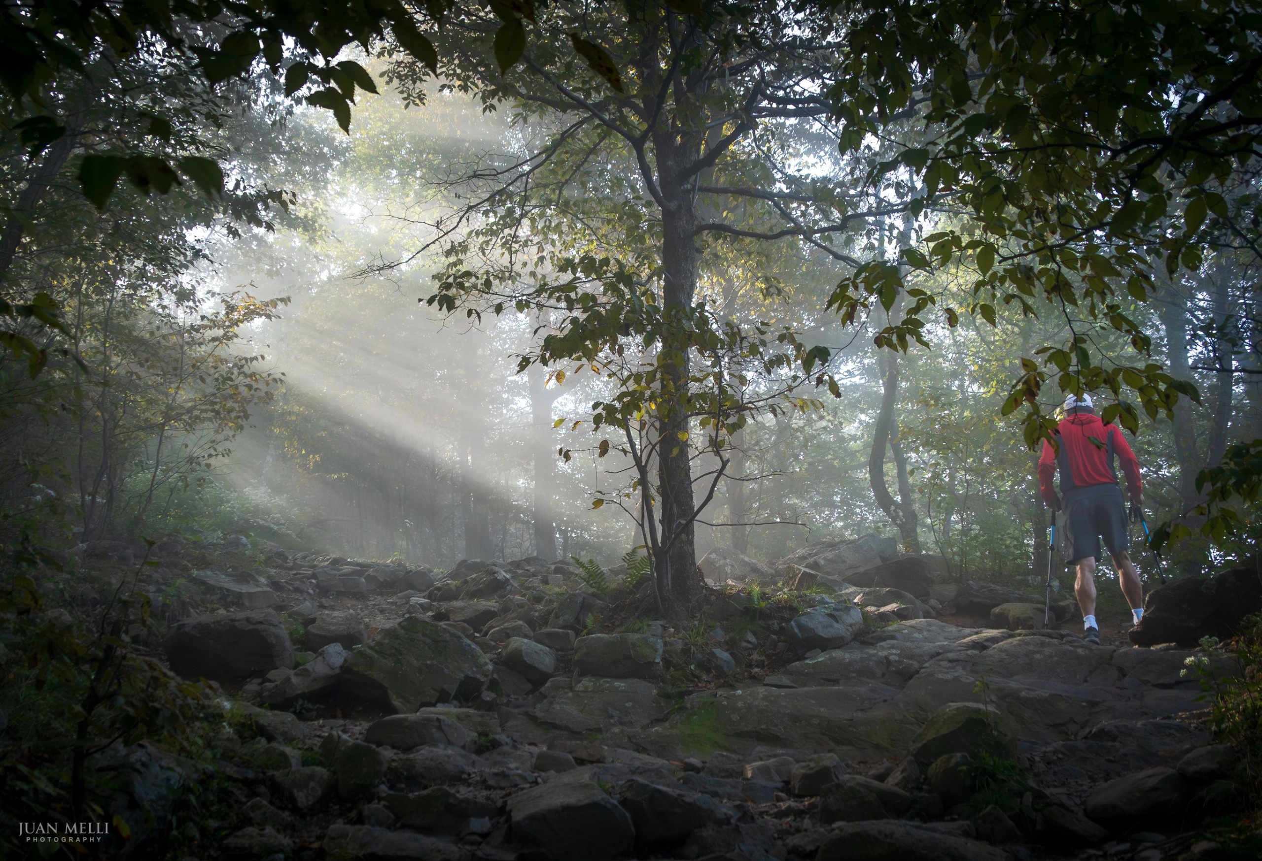
On the way up the Red Dot Trail


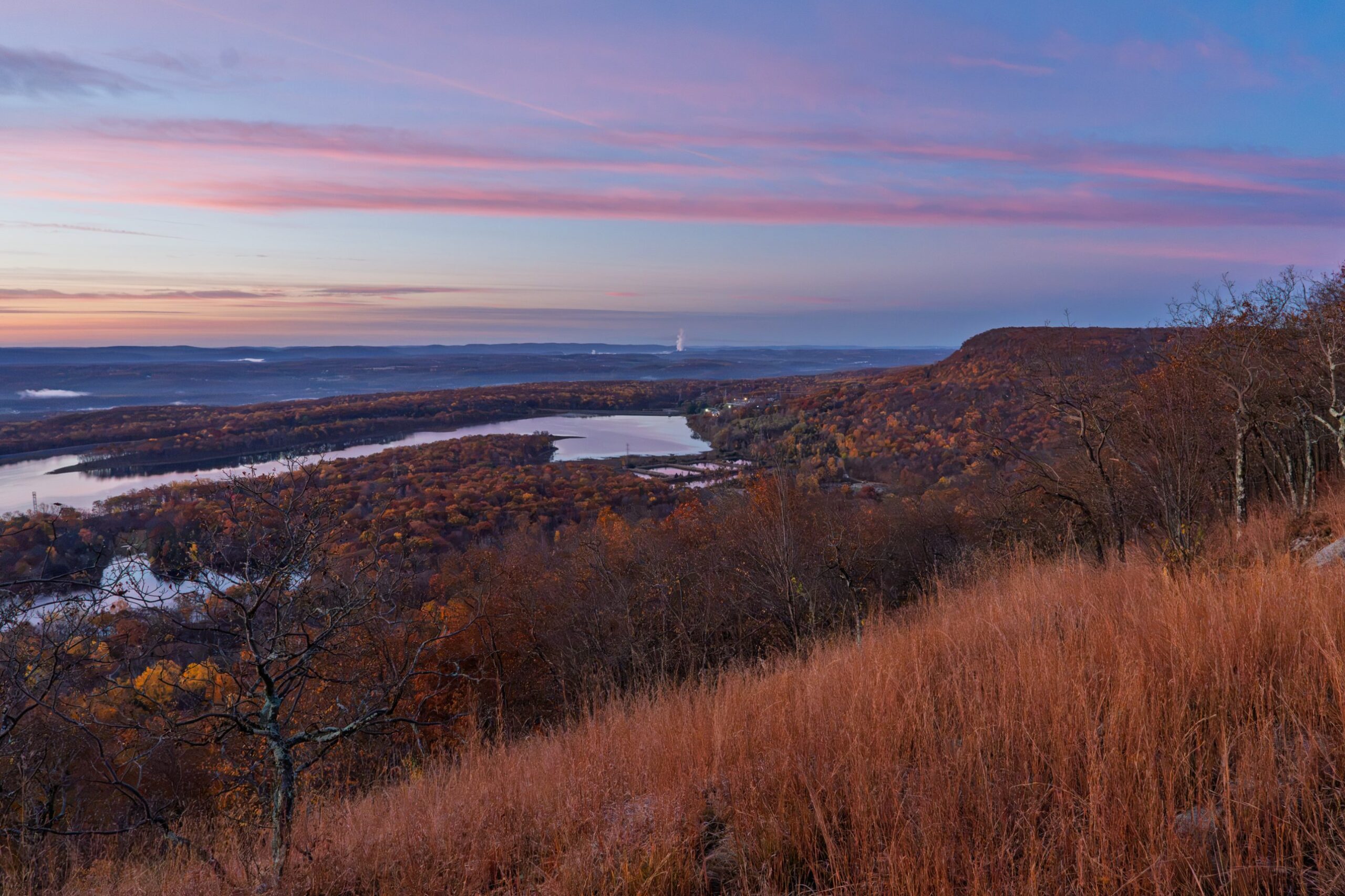
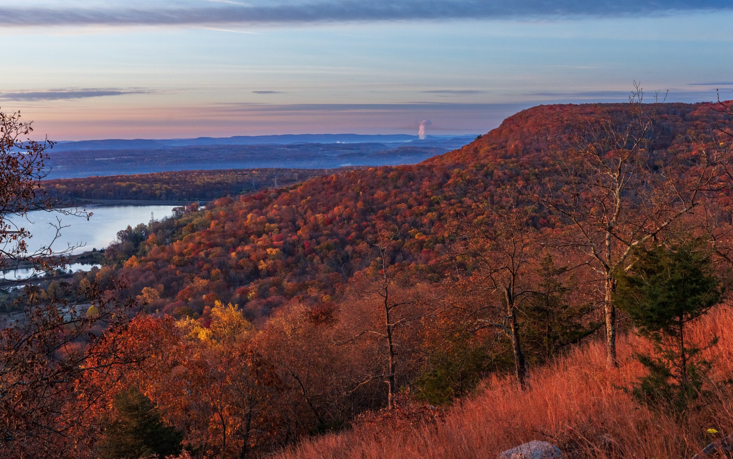
Mount Tammany from the Kittatinny Ridge
These two are views of Mount Tammany, not from it. I took them from several miles north, just past Raccoon Ridge, on a section of the Appalachian Trail that I maintain. That’s a different and longer hike, not the Red Dot loop most people do.


Photographing Mount Tammany
Here’s what I’ve learned from photographing Tammany in every season.
Where to shoot
The clearer view. The summit view, where the red dot trail ends, is where most people take their photos, and you can get good compositions there. But trees and the rock scramble below you block part of the river, and you’ll miss the clean view of the S-curve. For that, take the optional scramble down to the clearer view. It’s steep and you’ll be using your hands, and going down is harder than coming back up. I find it easier to go down along the right side.
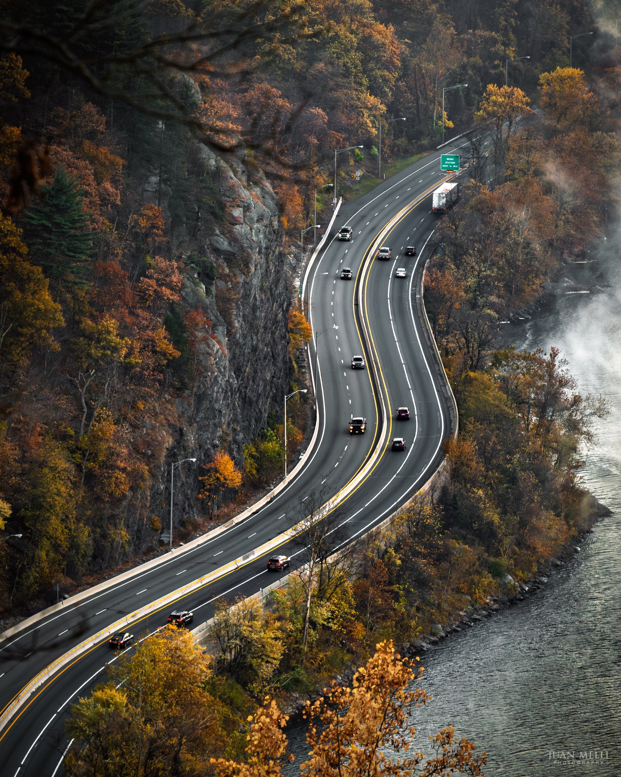
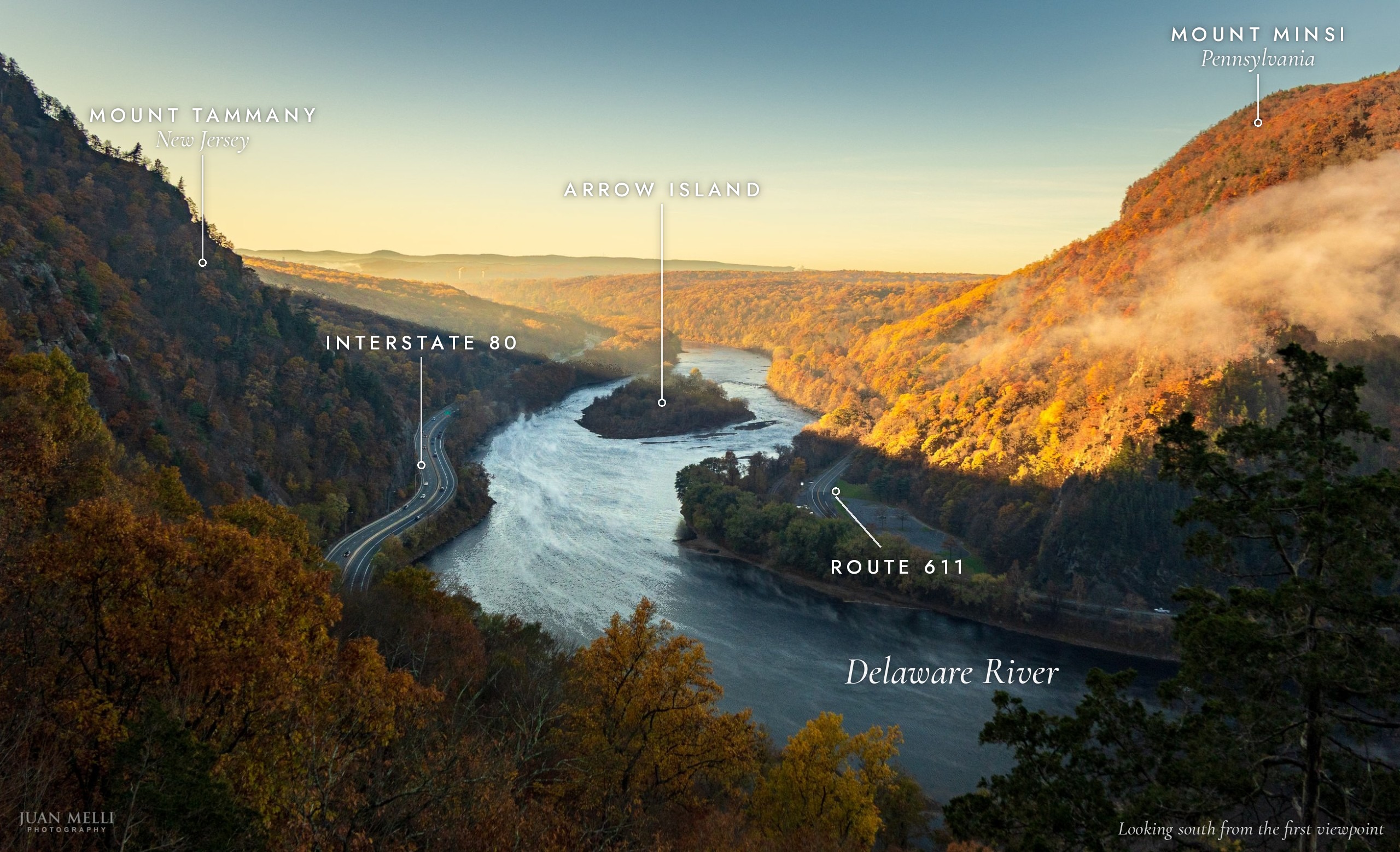
The first viewpoint. It faces south, with about 180 degrees of view from east to west. Some spots along the cliff are less obstructed than others, and the clearest is a little farther up the path. I used a longer focal length, about 125mm, to isolate the curve of I-80 squeezed between the cliffs and the river.
The unofficial viewpoint. This is where I shot the book cover, and it’s the best angle for capturing Arrow Island, which you can’t see from the main summit viewpoint. The book cover was about 27mm. It’s off trail, so only go if you can navigate.
Foreground and details. The rocks and pitch pines at the edge make good anchors, and the tall trees on the left can frame a wider shot, like the one on the map set. With a longer lens, the cliffs on Minsi make strong compositions on their own.
Light
Sunrise. The view looks west across to Minsi, so the sun comes up behind you and lights the mountain’s face. How soon depends on the season. In late spring and summer the sun rises in the northeast, almost directly behind Tammany as seen from Minsi, so Tammany’s shadow covers much of Minsi for a while. From fall through winter it rises farther to the southeast, and the light reaches Minsi sooner, starting with the southern part of the ridge.
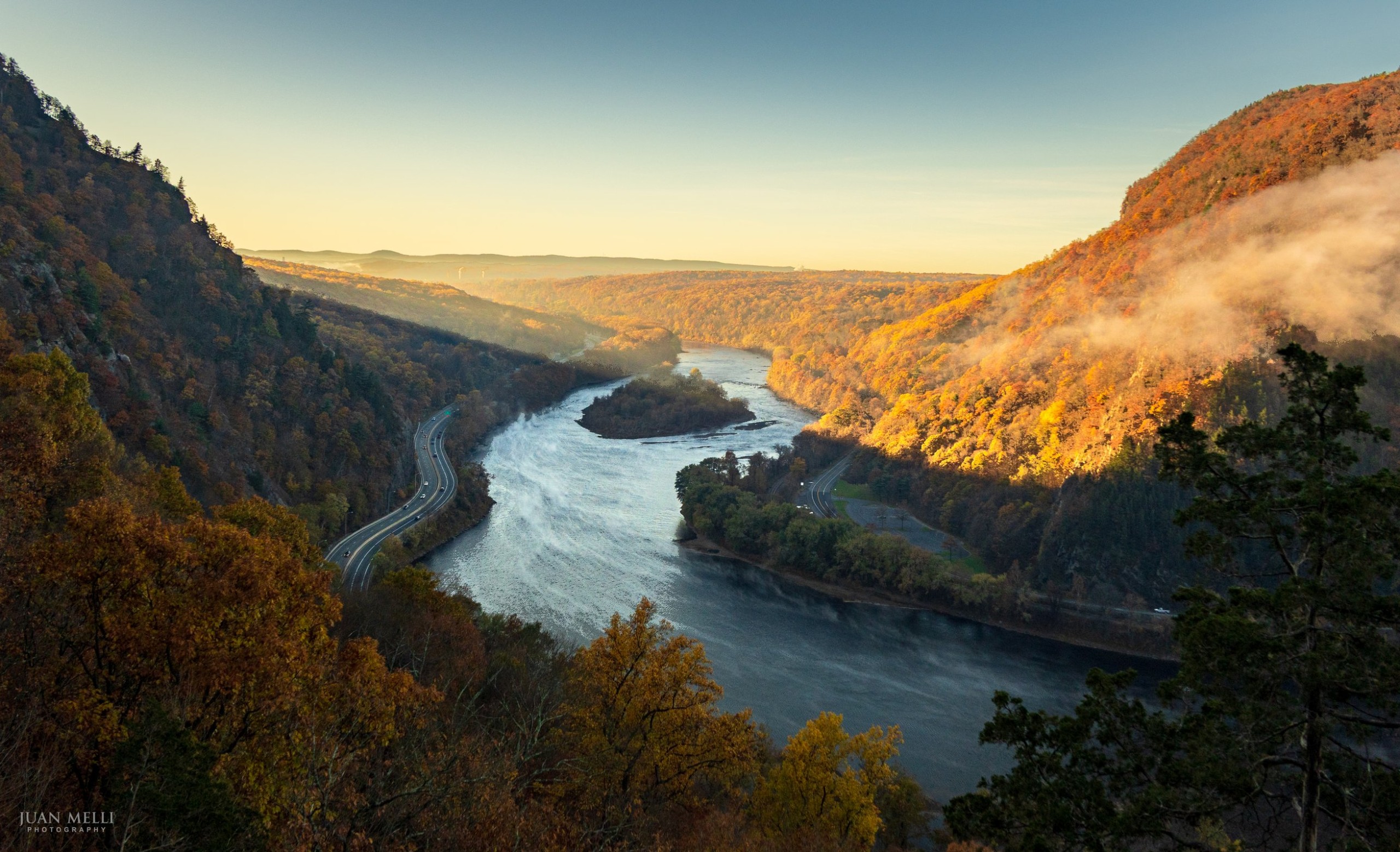
Fog. Late summer and fall are the best times to catch mist on the Delaware, especially at sunrise after a clear, calm night. Some mornings, wisps trace the bend in the river. Other mornings, fog fills the valley and hides the water while Minsi rises above it. It usually thins as the sun warms the valley. When low clouds sit right on the ridge, the whole view can disappear.
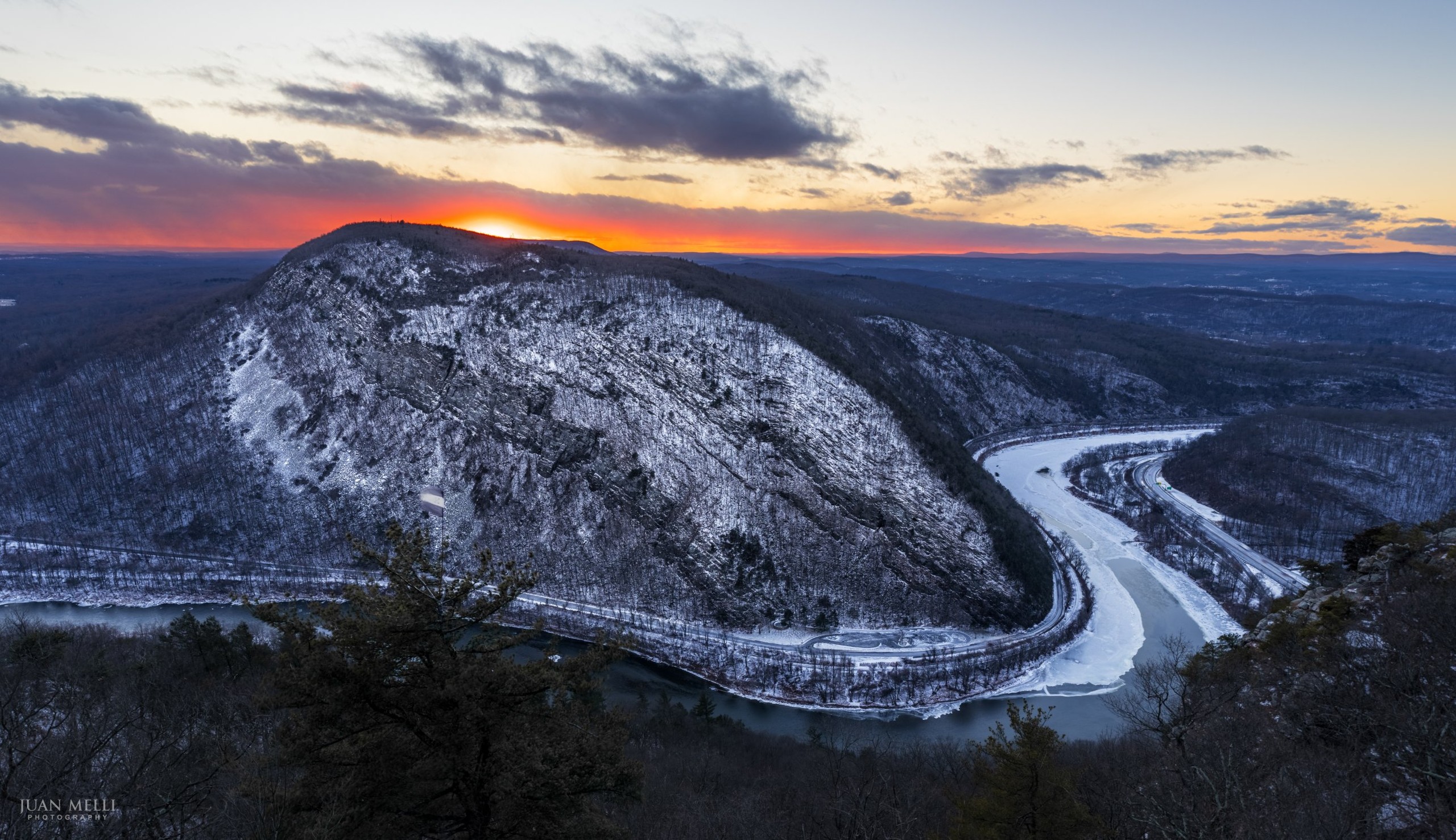
Sunset. The sun sets behind Minsi, so the side facing you is in shade, and if you’re trying to capture fall color, it can be a challenge. The sunstar photo above was taken a few days before peak, and you can see the color doesn’t come through. Hope for high clouds that catch color behind the mountain, and stay for the afterglow, when the light softens. The sunset point moves with the seasons: in fall it’s behind Minsi, in winter it moves left (south) toward Minsi’s summit, and in summer it’s well to the right (north), so you can come back for different compositions. The table below shows the direction by month, and an app like PhotoPills or The Photographer’s Ephemeris shows exactly where it will set on a given day.
Daytime. For fall color, morning or daytime light is easier, as long as the sun isn’t harsh. A polarizer helps cut glare and deepen the color during the day, though it doesn’t do much at sunrise or sunset.
Seasons
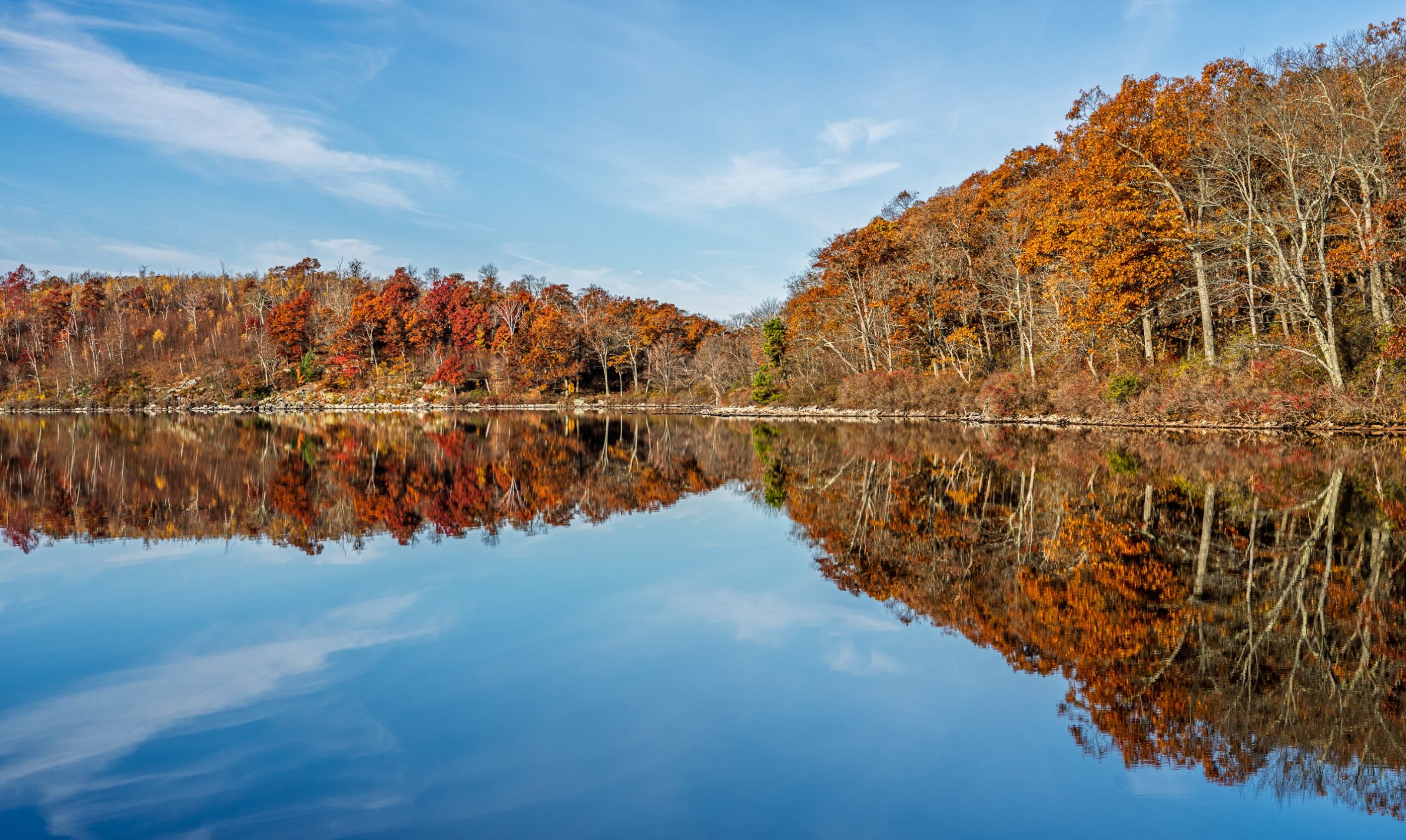
Fall color. First color shows in late September or early October. Peak usually falls between October 18 and 26, but it varies from year to year, so check the New Jersey Forest Service’s weekly foliage map, posted on Fridays in the fall, as the date gets close. After peak, the maroon and copper leaves still make gorgeous photos into early November, before they drop. Against the bright white cliffs, the maroon makes a beautiful scene.
Winter ice. January and February are the best months for ice on the Delaware. After a long cold spell, ice can fringe the banks and floes drift through the Gap, often with a ribbon of open water tracing the bend. The winter sunset above is from January.
Sun and weather by month
| Date | Sunrise | Sunset | Sun sets toward | Avg. high | Avg. low |
|---|---|---|---|---|---|
| Jan 1 | 7:25 AM | 4:43 PM | WSW | 37°F | 21°F |
| Feb 1 | 7:11 AM | 5:17 PM | WSW | 36°F | 19°F |
| Mar 1 | 6:35 AM | 5:51 PM | W | 43°F | 24°F |
| Apr 1 | 6:44 AM | 7:25 PM | W | 55°F | 32°F |
| May 1 | 5:59 AM | 7:57 PM | WNW | 69°F | 43°F |
| Jun 1 | 5:31 AM | 8:26 PM | WNW | 76°F | 52°F |
| Jul 1 | 5:32 AM | 8:36 PM | WNW | 84°F | 60°F |
| Aug 1 | 5:56 AM | 8:17 PM | WNW | 84°F | 61°F |
| Sep 1 | 6:27 AM | 7:33 PM | W | 80°F | 57°F |
| Oct 1 | 6:57 AM | 6:43 PM | W | 69°F | 46°F |
| Nov 1 | 6:31 AM | 4:56 PM | WSW | 57°F | 35°F |
| Dec 1 | 7:06 AM | 4:33 PM | WSW | 45°F | 28°F |
What to bring
- Lenses: I bring a 20–70mm for the wide scene and a 70–200mm for tighter shots. The winter sunset above was 20mm at f/8. All focal lengths in this guide are full-frame equivalents.
- A tripod for sunrise, sunset and fog.
- A polarizer for daytime color.
- Spare batteries, kept in an inside pocket in cold weather, and a lens cloth for fog and dew.
- Trekking poles. The trail is steep, especially on the way down.
- The Ten Essentials, including a headlamp and extra layers. The summit is exposed and windy, and you’ll be hiking down in the dark after sunset.
Mount Tammany hike: trail map, parking and route
Mount Tammany at a glance
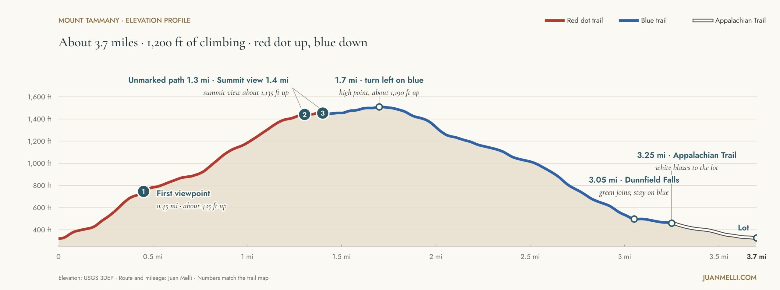
Distance: About 3.7 miles as a loop
Elevation gain: About 1,200 feet, plus about 140 if you do the optional scramble
Difficulty: Hard. It’s short, but steep and rocky.
Trails: Mount Tammany Trail (red dot) up, Pahaquarry Trail (blue, formerly the Blue Dot) down, then the Appalachian Trail back
Where: Worthington State Forest and the Delaware Water Gap National Recreation Area, Warren County, NJ
Dogs: On a leash no longer than 6 feet
Restroom: Portable toilet at the trailhead
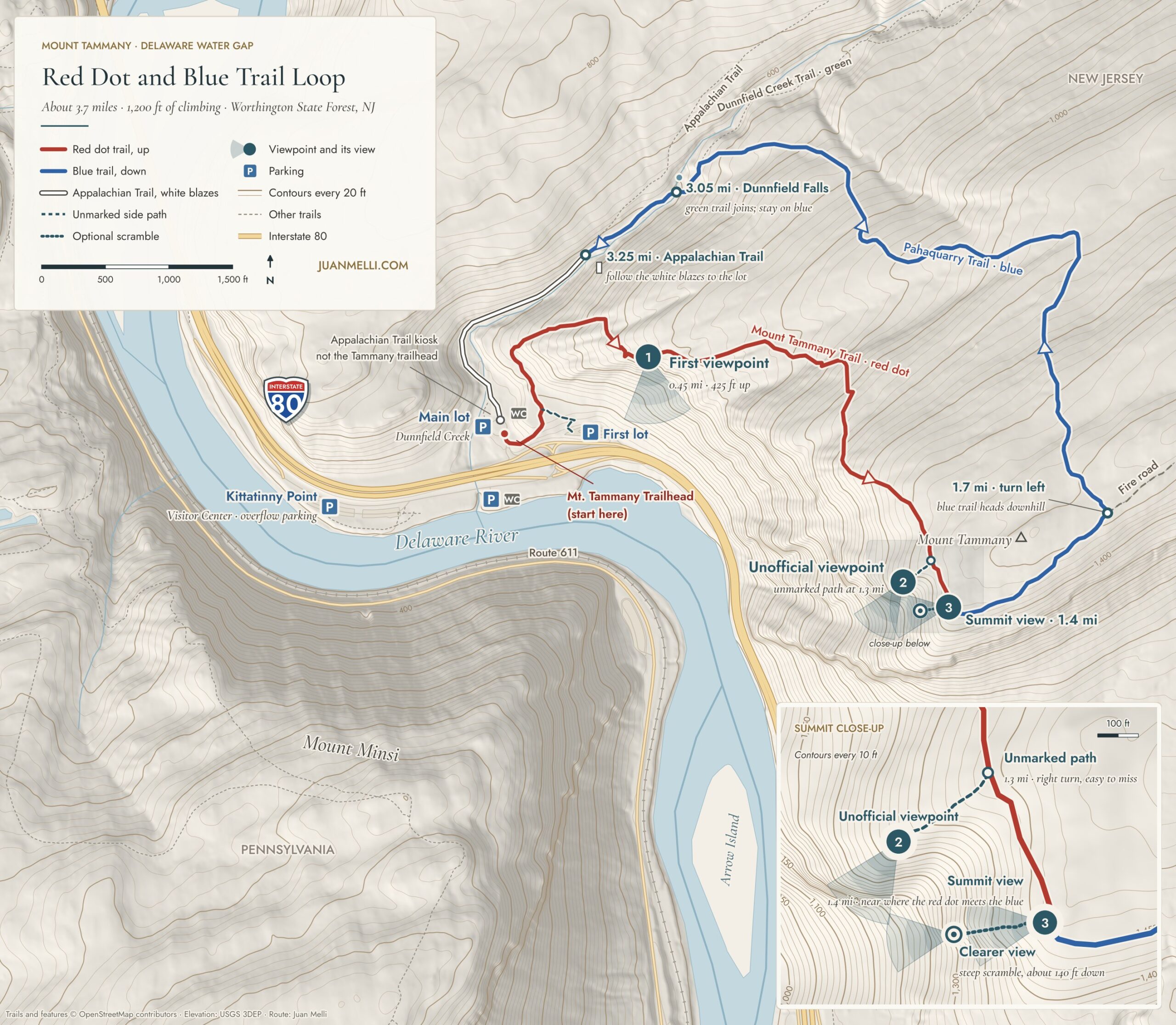
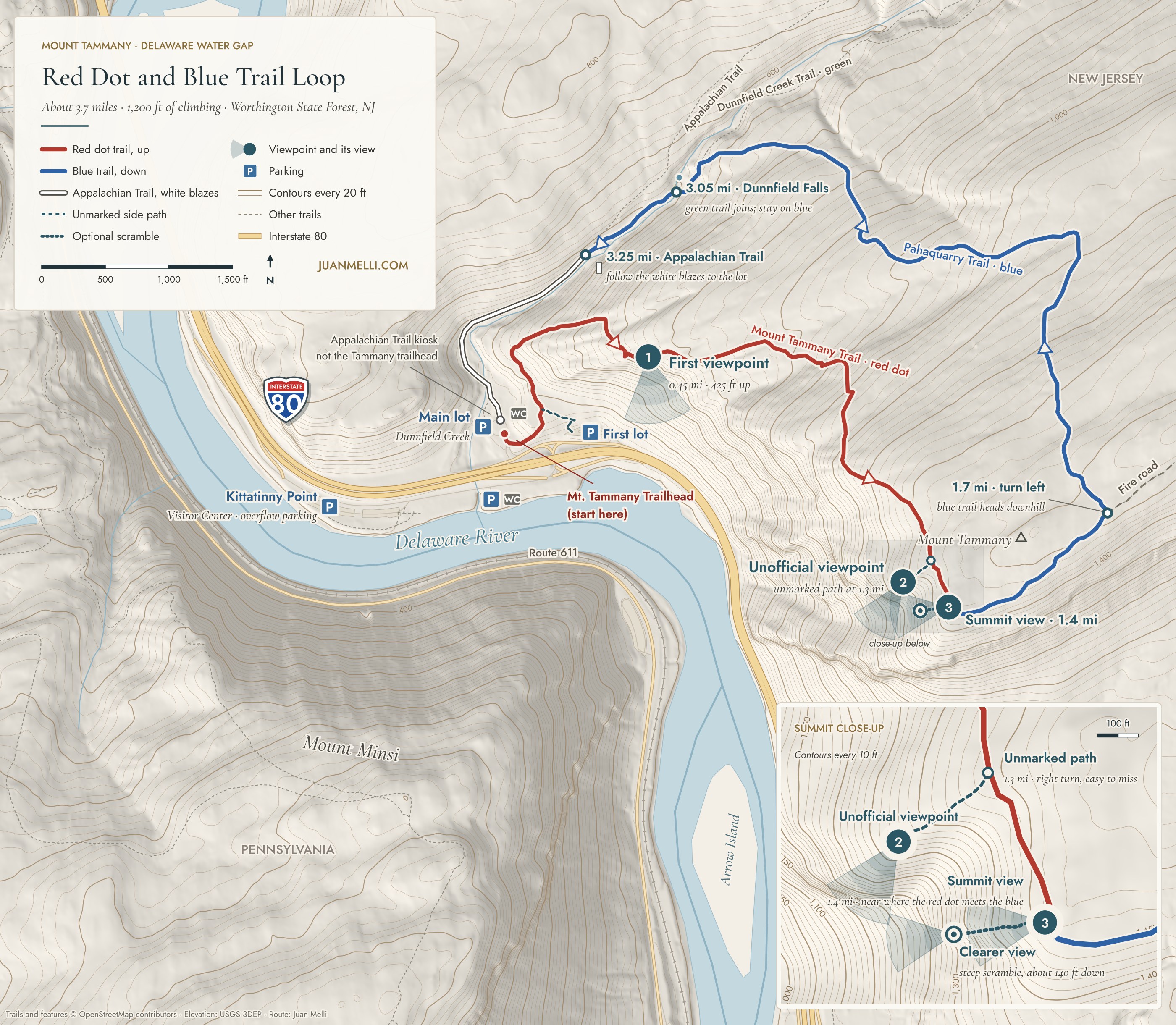
Open the full-size Mount Tammany trail map to zoom in or print it.
More Mount Tammany maps
Buy the map. The Trail Conference’s Delaware Water Gap & Kittatinny Trails map set ($15.95) covers Tammany, Sunfish Pond and the rest of the Kittatinny Ridge. It’s waterproof and tear-resistant, and the money goes back into maintaining these trails. This is the one with my photo on the back insert.
There are also two free maps you can print: the Trail Conference’s Worthington State Forest map and the state park service’s Worthington trail map. The Trail Conference PDF is older and may show the Pahaquarry Trail under its old name.
Mount Tammany parking
Park at the Dunnfield Creek parking areas off I-80. Westbound, take the exit signed “Dunnfield Creek / Appalachian Trail” and keep right for the first lot. If it’s full, continue past the turn for the I-80 underpass and keep right for the main Dunnfield Creek lot. The road between them is one-way, so you can’t easily circle back. If you see a spot in the first lot, take it. Both fill up fast, so come early or on a weekday.
Open in Google Maps: first lot · main Dunnfield Creek lot
The route, step by step
Follow the blazes. For a lot of people this is one of their first real hikes, so you’ll want a basic sense of how trails are marked. There are official trails, but there are also “social trails,” where people walk off trail and create their own. That’s a problem: they can get people lost or into dangerous spots, and they trample sensitive plants and wildlife areas and cause erosion.
Each trail has its own colored “blaze,” a painted or nailed-on mark on trees and rocks showing the route. On this loop, the Mount Tammany Trail is a red dot on white, the Pahaquarry Trail is blue, the Dunnfield Creek Trail is green and the Appalachian Trail is white. When you see two blazes stacked on top of each other, it indicates a turn: the top one is offset toward the direction of the turn. If you haven’t seen a blaze in a few minutes, go back to the last one you saw. The unmarked path to the unofficial viewpoint has no blazes at all, which is why I only suggest it if you’re experienced and comfortable navigating and finding your way back.
- 0.0 mi · Mount Tammany Trail trailhead (red dot). From the main lot, look for the Mount Tammany Trail sign near the lot entrance, at the southeast end of the lot. The Appalachian Trail kiosk at the north end of the lot looks like the trailhead, but it’s the wrong one. While doing trail maintenance several miles north of here on the AT, I’ve met hikers who thought they were on the Tammany trail and asked me for directions. Needless to say, they were very far off track. Climb the stone steps and bear left at the fork to follow the red dots. The right fork goes to the first lot, the one you pass on the way in.
- 0.45 mi · First viewpoint (about 425 feet up). It faces south, with views east and west, across the river to Minsi and down on I-80. The least obstructed spot is a little farther up the path. From there the trail leaves the cliffs and keeps climbing.
- 1.3 mi · Unmarked path to the unofficial viewpoint (about 1,125 feet up). The path heads off to the right, toward the river, to a lesser-known viewpoint where I took the photo on the book cover. Enough people know about it that you can usually follow the path, but it may take some routefinding. Only look for it if you know how to navigate.
- 1.4 mi · Summit view (about 1,135 feet up). The red dot trail ends near this point, where it meets the blue trail. You can already see Minsi and the river from here. If you want a clearer view, there’s an optional scramble down the rocks toward the river. It drops about 140 feet in about 200 feet of distance, so it’s steep and you’ll want to use your hands. Be very careful. There’s an obvious end point to the descent where you can stop for a break and a snack. Take your time, and only go as far as you’re comfortable. All my summit photos are from down there (it isn’t the true summit), and it has the clearest view of the river’s S-curve. Whatever you go down, you have to climb back up.
- 1.7 mi · Turn left onto the blue trail. You could do the hike as an out and back, but I recommend the loop. The blue trail is a less steep way down than the red dot. From the summit view, follow the blue-blazed Pahaquarry Trail across the ridge for about 0.3 mile to a junction where the Mount Tammany Fire Road continues straight. Turn left to stay on the blue trail as it heads downhill.
- 3.05 mi · Dunnfield Falls. The blue trail meets the green Dunnfield Creek Trail at the falls. Stay on the blue trail.
- 3.25 mi · Appalachian Trail. Join the white-blazed AT for the last stretch.
- 3.7 mi · Back at the lot. From the summit view it’s about 2.3 miles back, mostly downhill, dropping about 1,200 feet.
Tips for hiking Mount Tammany
Bring trekking poles. They help on the way up and even more on the way down. It’s steep.
Dress for the summit. It’s exposed and often windy up top, even when it’s calm at the lot. Bring layers, plus gloves or hand warmers.
In winter, bring traction. Both trails get so much traffic that the snow gets packed down into ice. Even if there’s no snow where you’re driving in, the trail can be a solid sheet of ice.
Going up for sunset? Bring a headlamp. The way down is steep, and it’s very easy to lose the trail in the dark.
For photographers. Minsi faces east, toward you, so morning light falls on it, and fog often lifts off the river early, sometimes thick enough to hide the view completely. In the evening you’re shooting into the sun, which is how the sunset photo above happened. More in the photography guide.
With kids. I’ve hiked it with my son. Kids can do it, but it’s a steep, rocky climb, so know what yours can handle.
Optional: add Sunfish Pond for a longer day
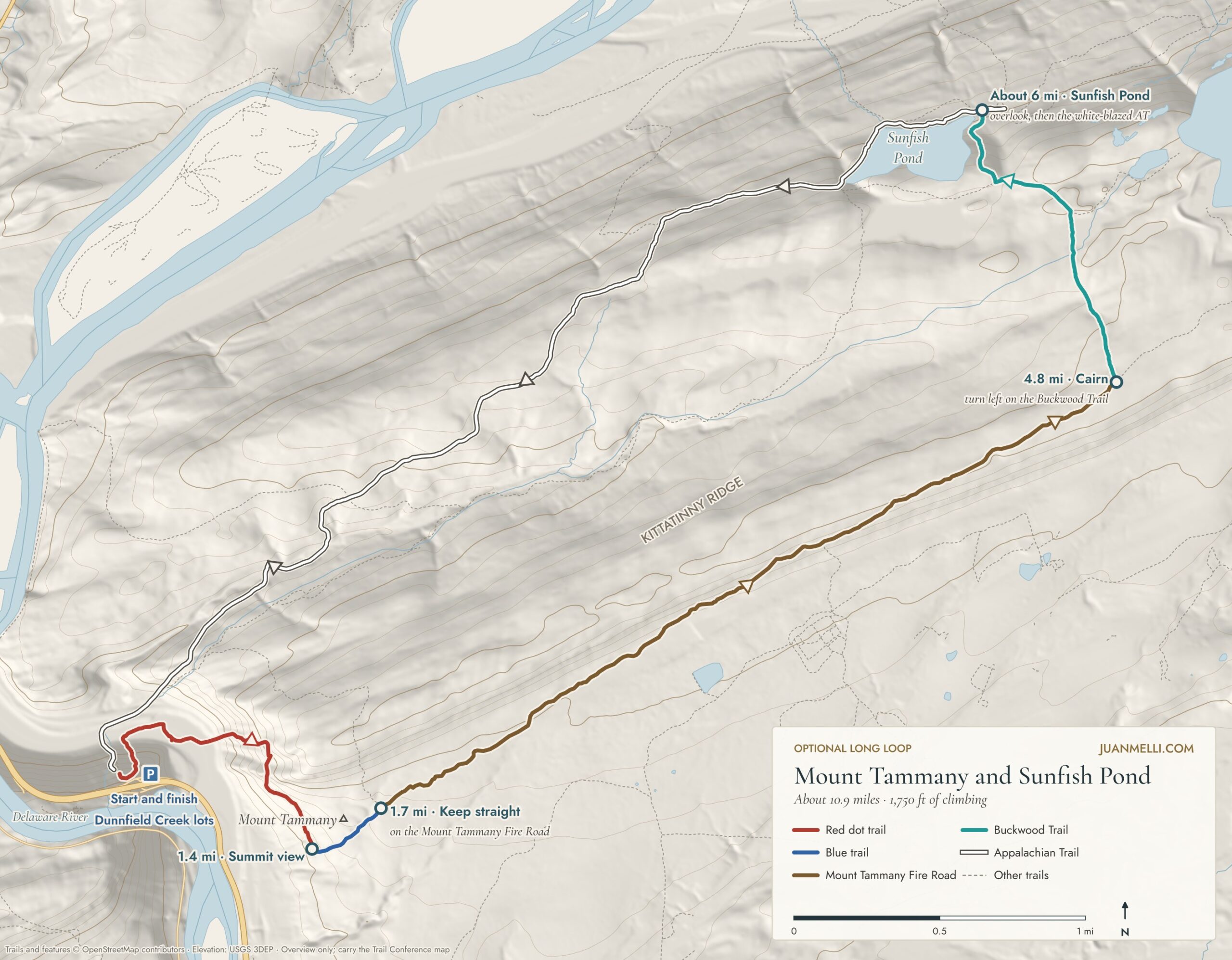
If you want a full day, you can turn the 3.7-mile loop into a much longer hike of about 10.9 miles and 1,750 feet of climbing. This is optional; for the standard loop, turn left onto the blue trail as described above. For Sunfish Pond, at the fire road junction, about 0.3 mile past the summit view, keep straight on the Mount Tammany Fire Road instead of turning left onto the blue trail. It’s a wide, easy walk along the ridge for about 3.1 miles. The road was cut as a firebreak after the 1976 Dunnfield Creek fire, and some days you can hear wolves howling from a wolf preserve about a mile east.
At the cairn, take the Buckwood Trail (formerly the Turquoise Trail) to an overlook above Sunfish Pond, a glacial lake on top of the ridge. Then follow the white-blazed Appalachian Trail along the pond and all the way back down to the lot. Bring plenty of water and the map.

The pond almost didn’t survive. In 1961 the state sold it to power companies that planned to turn it into a pumped-storage reservoir. I’ve written a series on how it was saved.
Mount Tammany FAQ
How long does the Mount Tammany hike take?
Plan on about 2.5 hours for the 3.7-mile loop, but it varies widely with pace, crowds, and how long you stay at the viewpoints. I’ve reached the summit in 25 to 30 minutes, but at a more leisurely pace, plan on about an hour to get up.
Where does the Mt. Tammany hike start?
At the Mount Tammany Trail trailhead (red dot), near the entrance at the southeast end of the main Dunnfield Creek lot, off I-80 westbound just before the Delaware River. The Appalachian Trail kiosk at the other end of the lot is the wrong trailhead. See parking for directions to the lots.
Is Mount Tammany hard?
For its length, yes. The loop is only 3.7 miles, but the Red Dot Trail climbs about 1,100 feet in 1.4 miles over steep, rocky ground, and you may need your hands for balance in spots. The blue trail down is less steep. For a lot of people it’s one of their first real hikes, so take your time and bring trekking poles.
Is there a fee?
No. There’s no fee to hike the trail or to park.
What if the parking lots are full?
Both trailhead lots fill quickly, especially on weekends and in the fall. If they’re full, you have two backups:
- Kittatinny Point Visitor Center. It’s just across I-80. There are no visitor services right now, but you can still park there and walk under the highway to the trailhead.
- Park and Ride in Delaware Water Gap, PA. The free lot is across from the PA Welcome Center, off I-80 exit 310. From there, it’s a walk of about a mile across the I-80 bridge walkway, the same way the Appalachian Trail crosses the river.
Don’t park on the highway shoulder.
Are the lots open before sunrise and after sunset?
In my experience, the parking lots have always been open 24 hours, except when they’ve been closed because they were at capacity.
How crowded is it?
Very. In my experience, there are people on the trail almost every day, at almost any hour, in almost any weather, in every season. Expect to pass or be passed by several groups. For fewer people, go early on a weekday.
Can kids hike Mount Tammany?
It’s challenging for adults and kids alike. The Red Dot Trail is steep and rocky. Nothing is technical, but you may need your hands for balance. Kids can do it if you know their ability. If it isn’t working, stop at the first viewpoint and turn around. For more, see my tips for hiking with kids.
Can I bring my dog?
Yes. Dogs are fine on this hike. Just know your dog, since the climb is steep and rocky. Keep them on a leash and pick up after them, and don’t leave the bag on the trail.
Is there cell service?
In my experience, service has been good along the trail.
Are there restrooms?
There are portable toilets at the north end of the main lot, and restrooms at the Kittatinny Point Visitor Center, across I-80.
When is the best time to photograph Mount Tammany?
It depends on what you’re after: fog, fall color, ice, or a sunset sunstar. My photography guide covers light, seasons, and where the sun sets month by month.
Many of these photographs are available as archival lustre prints with a white conservation-grade mat. Use the print link under any photo to request one.